LIVE UPDATES: Flash Flood Warnings issued, including Dallas, Tarrant counties

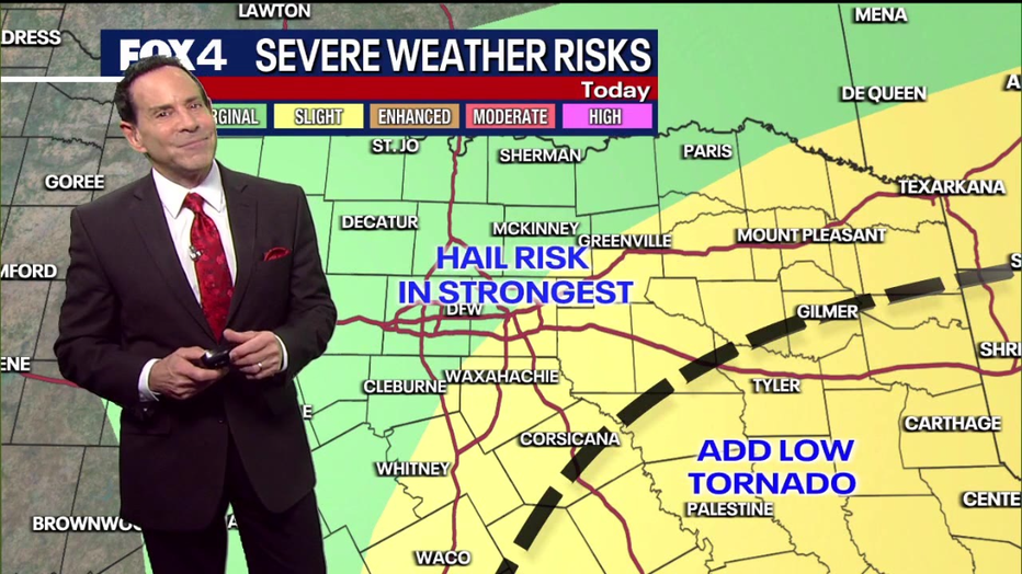
DALLAS – Severe storms are expected in the DFW area Thursday, bringing the potential for quarter-sized hail and gusts of up to 50 mph.
JUMP TO SECTION: Live Radar | Thursday Forecast | 7-Day Forecast
Live Updates
12 p.m.
Dallas weather: Dec. 26 afternoon forecast
FOX 4 meteorologist Ali Turiano talks about the Flash Flood Warnings across North Texas and what else we can expect.
Updates on the weather from FOX 4 meteorologist Ali Turiano during FOX 4 News at Noon.
11:39 a.m.
More watches and warnings are coming in.
Flash Flood Warnings are in effect for much of the heart of the Metroplex.
A Tornado Watch has been issued for our far southeastern counties, Anderson, Freestone, and Limestone, until 7 p.m.
11:25 a.m.
A Severe Thunderstorm Watch was issued for our eastern counties until 7 p.m.
10:54 a.m.
A Flash Flood Warning was issued for Dallas, Denton, and Tarrant County until 2:00pm Thursday.
10:46 a.m.
Flights at Dallas Love Field and DFW Airport are under a ground stop due to thunderstorms.
DFW’s is expected to end at 11 a.m., while Love Field expects to be under a ground stop until 11:30 a.m.
10:31 a.m.
Severe Thunderstorm Warning for Ellis, Hill, and Navarro County until 11:15 a.m.
10:14 a.m.
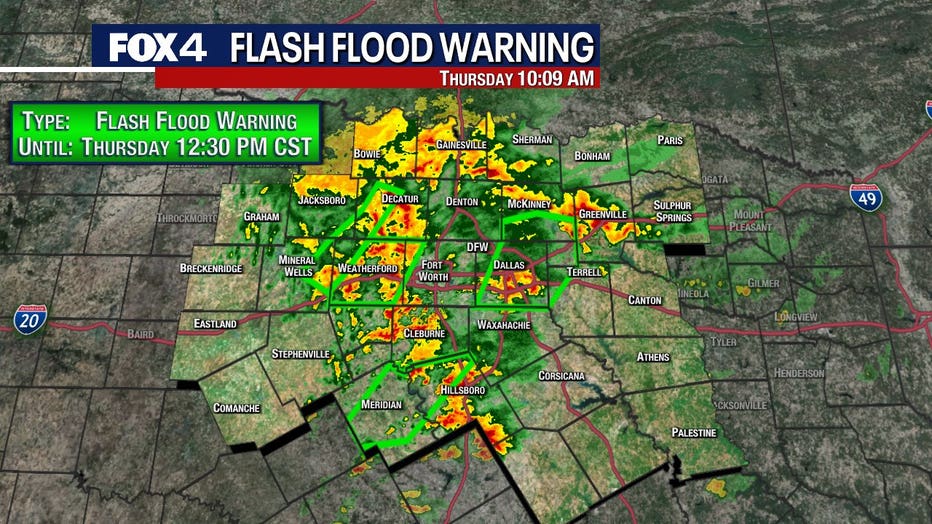
Flash Flood Warning for Collin, Dallas, Kaufman and Rockwall County until 12:30pm Thursday.
10:03 a.m.
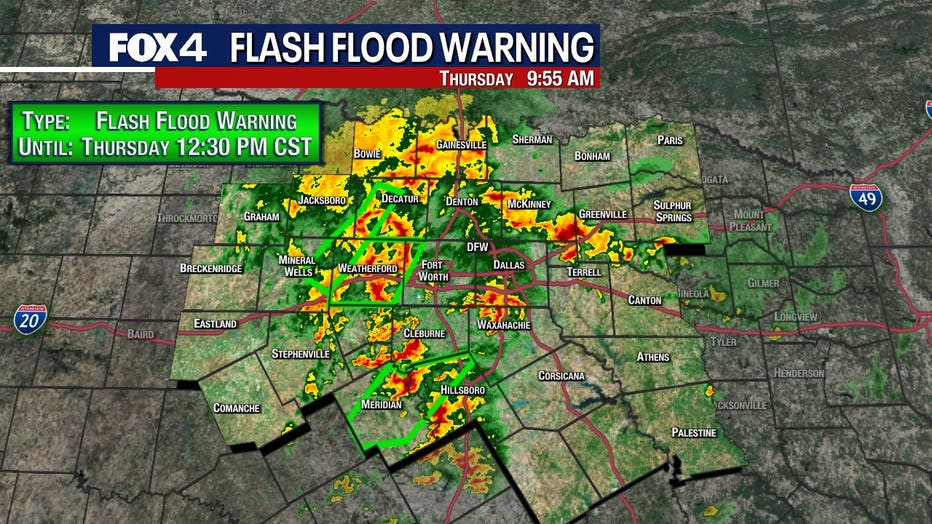
Parker and Tarrant County are now under a Flash Flood Warning until 12:30pm Thursday
9:50 a.m.
Jack, Palo Pinto, Parker and Wise County are under a Flash Flood Warning until 11:30am Thursday.
Bosque and Hill County are under a Flash Flood Warning until 11:00am Thursday
Live Radar North Texas

Dallas-Forth Worth Forecast
Dallas weather: Dec. 26 late morning forecast
FOX 4 meteorologist Evan Andrews takes a look at the strong to severe storms moving through North Texas.
Rain will begin in North Texas around 9 a.m. and continue until about 3 p.m. Most thunderstorms are expected to peak between 11 a.m. and noon.

Residents should park vehicles in covered areas during this time to avoid hail damage. The hail risk is expected to diminish around 1 p.m.
DOWNLOAD THE FOX 4 WAPP FOR LIVE RADAR
While quarter-sized hail and strong winds are the main threats, humid air from the Gulf creates a slight tornado risk in areas south of DFW, near Palestine and Corsicana.
Heavy fog is also impacting parts of the Metroplex this morning.
Conditions will improve by the evening, with temperatures warming to the low 70s on Friday.
7-Day Forecast

After Thursday’s storms, things should stay dry North Texas.
Highs will climb into the 70s on Sunday and Monday before temperatures fall on Tuesday.


