Weather system to strengthen to category three storm

Tropical Cyclone Alfred is forecast to strengthen to a category three storm off the Queensland coast by early tomorrow.
In an update today, the Bureau of Meteorology said the weather system was sitting 900km north-east of Mackay but its future track remains “highly uncertain”.
“Today and tonight, we expect it to very slowly move towards the south-east and slowly intensify as well,” said senior meteorologist Dean Narramore.
The bureau has been monitoring Tropical Cyclone Alfred since it formed off the Far North Queensland coast on Sunday.
Its strength has grown as it moved south over the Coral Sea.
By early tomorrow it is forecast to reach category three level and remain at that strength on Thursday and Friday as it lumbles south and further away from the Queensland coast.
Looking ahead at the cyclone’s potential direction on the weekend, Narramore said there were different potential scenarios.
Narramore said there were a range of possible scenarios for the cyclone’s movement over the weekend.
They include the system tracking towards the coast by late on the weekend.
“Some (scenarios predict it) continue moving further south, well off the Queensland coast and continuing that well into next week,” he said.
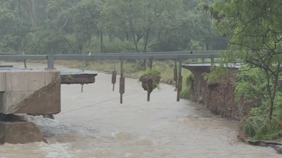
ADF to build temporary bridge to give access to flood-ravaged town
“Some even weaken it below cyclone strength as we get towards the weekend into early next week.”
Currently, the cyclone’s impact on Queensland weather is limited to gusty winds.
The bureau issued strong wind warnings for coastal waters on coastal areas for Townsville and Mackay, the Capricorn coast and Fraser Island for today and tomorrow.


